Arctic Sea Ice Extent Reaches Record Low for Second Consecutive Year: Implications and Trends
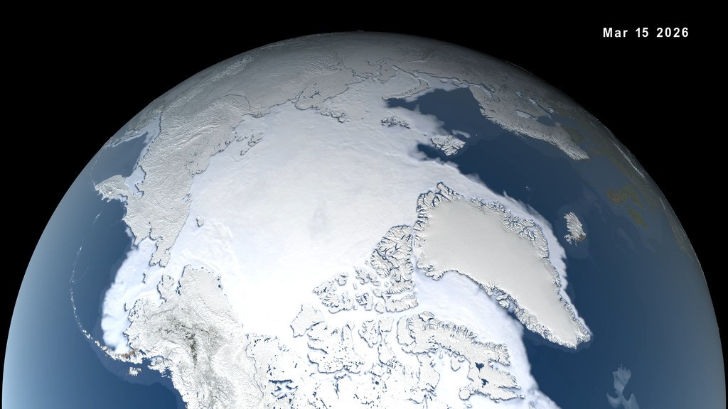
Arctic sea ice extent during the winter has reached a record low for the second year in a row, matching the lowest peak observed since satellite monitoring began in 1979. The extent of Arctic sea ice on March 15 was very close to the previous year's peak, with scientists noting changes in ice thickness, particularly in the Barents Sea and the Sea of Okhotsk. This trend continues the long-term decline in Arctic ice cover observed over the past few decades.
The peak ice coverage in the Arctic this winter was below the average levels between 1981 and 2010 by approximately half a million square miles. Sea ice extent is defined as the total area of the ocean with at least 15% ice concentration, and the Arctic Ocean's ice cover expands during the cold winter months. However, less new ice is forming, leading to a decrease in multi-year ice accumulation over time.
While a low year or two may not have significant implications on their own, when viewed in the context of the long-term downward trend since 1979, they contribute to the overall picture of Arctic sea ice changes throughout the seasons. In contrast, Antarctic summer sea ice reached an annual low this year but showed an increase compared to the unusually low levels of the past four years.
Scientists at the National Snow and Ice Data Center (NSIDC) track sea ice extent using various satellite data sources, including JAXA's Advanced Microwave Scanning Radiometer 2. They also compare current ice coverage to historical data collected by satellites like Nimbus-7 between 1978 and 1985. These observations help researchers understand the ongoing changes in sea ice extent in both the Arctic and Antarctic regions.
In conclusion, the recent trends in Arctic and Antarctic sea ice extent highlight the ongoing changes in polar ice cover and the importance of monitoring these regions to better understand the impacts of climate change on the Earth's polar regions.